




Our 2026 Impact Report 🚀 - Read more(opens in a new tab)
Treeapp logo with certified B Corporation

How Treeapp plants trees

Restoring nature where it’s needed most

Across 20+ countries, Treeapp designs every project around its local landscape, using native species, working with local communities and monitoring for the long term.

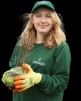
Treeapp team member holding a tree root ball in front of satellite imagery of a monitored reforestation site in the UK

Certified and recognised by

Our impact in numbers

The measurable impact of our approach tracked across projects in 20+ countries.

Survival rate

Our global average across projects in more than 20 countries. Survival is measured as the percentage of trees still alive at a set point after planting, and naturally varies by ecosystem.

Carbon absorption

This is an estimate of the total CO₂ the trees we’ve planted will absorb over their lifetimes, based on an average of around 109 kg per tree across the species we plant. Absorption rates varies over time: fast-growing species capture more carbon early on, while slower-growing, longer-lived species keep absorbing for decades.

Land restored

The total area our projects have restored to date. Every site is mapped before planting, so the area restored can be measured accurately and tracked over time.

Workdays created

The paid local employment our projects create, from nursery work and site preparation to planting, monitoring and long-term maintenance, supporting livelihoods in the communities behind every forest we grow.

Different landscapes need different approaches

No single planting method works everywhere. Treeapp’s process stay consistent, but species, site preparation, planting density & monitoring are adapted to each ecosystem.

Agroforestry planting

Tap to find out more

Trees alongside agriculture

Trees are planted alongside agricultural crops, so the land supports farming, biodiversity and local livelihoods.

Our approach:

We select species that complement existing agricultural activity, including fruit and nut trees for food and income, and nitrogen-fixing species that improve soil fertility for surrounding crops.
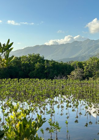
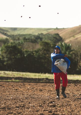
Mangrove restoration

Tap to find out more

Coastal & intertidal ecosystems

Salt-tolerant mangroves are restored along coasts and tidal flats, where tides and saltwater shape every planting decision.

Our approach:

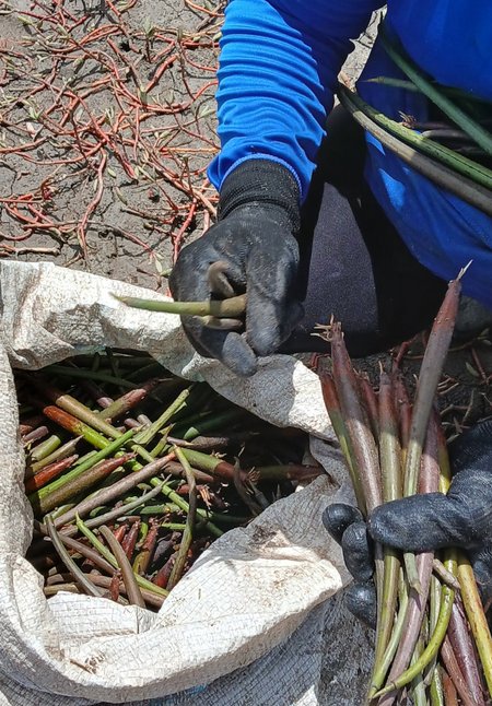
Mangrove propagules (naturally sprouting seedlings) are planted directly into silt or first grown in nearby nurseries. Species and planting spots are chosen around tides, salinity and the marine ecosystem.

Direct seeding

Tap to find out more

Growing forests from seed

Seeds are sown directly into prepared land, instead of planting individual saplings grown in a nursery.

Our approach:

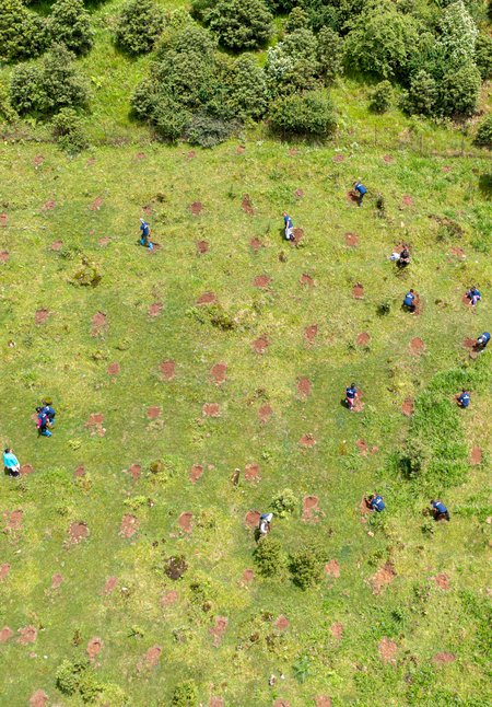
We use Muvuca, a direct seeding method in which up to 60 native species are sown together into prepared ground at the start of the rainy season, when moisture is at its most reliable for germination and early growth.

Miyawaki method

Tap to find out more

High-density native woodland

Following Akira Miyawaki’s method, native trees are packed densely into small areas for fast, natural growth.

Our approach:

Trees are planted far more densely than in standard woodland creation. Species of different sizes and canopy layers are mixed closely together, encouraging fast vertical growth and a varied structure.

Start planting

Our tree planting process

From the first site assessment to long-term monitoring, every Treeapp project follows the same five stages, adapted to each landscape.

Analysis before action

Understand the landscape

Before Treeapp designs a planting scheme, we build a detailed evidence base for the site. Field observations are combined with environmental and spatial datasets to understand what can be planted, which parts of the site are suitable and how it is likely to change over time.

Our assessment covers the physical environment (soil, terrain and moisture), the ecological context (existing vegetation, habitats, canopy cover and invasive species) and site constraints (current land use, protected areas and statutory requirements).

We also use meteorological and climate data to understand rainfall, flood risk and drought risk. Together, this evidence shapes the next stage: selecting species and designing a planting approach suited to that landscape.

Our teams draw on field data alongside specialist mapping and environmental datasets. In the UK, these can include DEFRA MAGIC maps, LandIS soil data and Google Earth terrain data. In other countries, we use the national equivalents.

Before and afters

See the difference our planting has made across some of our sites.

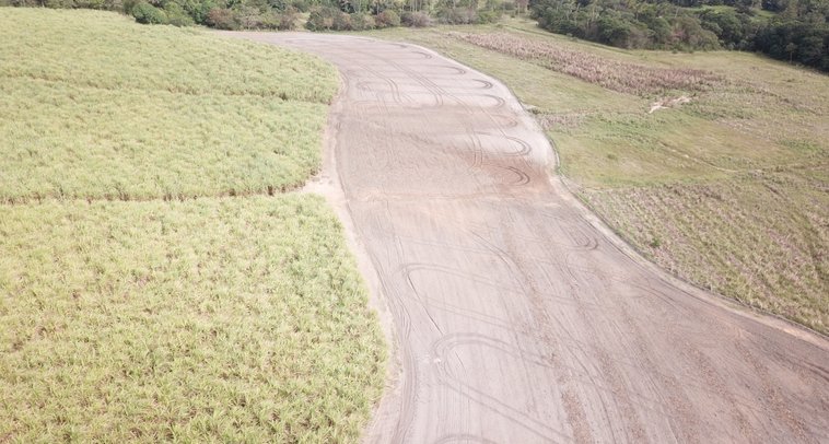
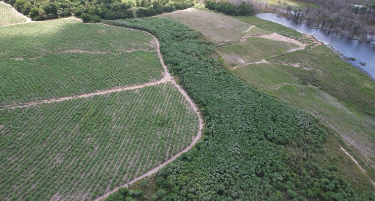
Brazil, before plantingBrazil, after 2 years
Brazil 2 years of progress
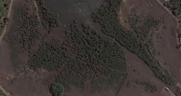
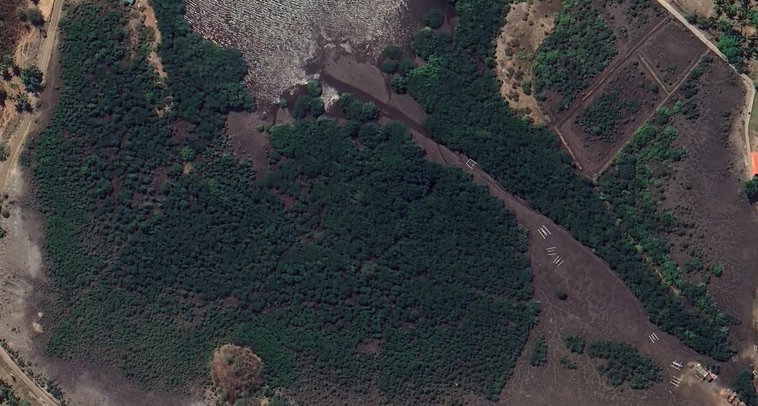
Aerial before-and-after of Indonesian mangrove restoration: bare mudflat to dense forest after 8 years.
Indonesia 8 years of progress

A closer look at our international projects

A selection of our projects, from mountain forests in Tanzania to mangrove coasts in Brazil, showing how each is shaped by its landscape.

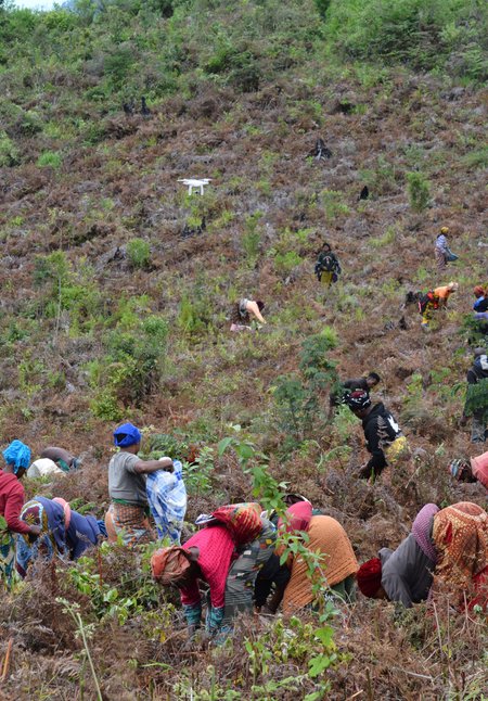
Women planting trees on a steep hillside in Tanzania while a drone flies overhead

TERRAIN AND BIODIVERSITY-LED RESTORATION

Restoring a mountain forest to protect biodiversity, soils and water

Challenge

Up to 85% of the original forest cover has been lost across Tanzania’s Western Usambara Mountains. The result is fragmented habitat, greater soil erosion and less reliable water flow across an already vulnerable mountain landscape.

Our approach

We use terrain maps and historic forest data to identify where restoration can have the greatest impact, while biodiversity records help inform a species mix that reflects the area’s original forest composition.

Key Practices

  • Terrain mapping
  • Historic reforestation data
  • Reduce soil erosion

Why it matters

Restoring tree cover on steep slopes does more than rebuild habitat. As trees establish, their roots help bind the soil, reduce erosion and slow surface run-off, supporting better water regulation while creating habitat for native wildlife.

Project evidence

  • 75%Est. survival rate
  • 35Species planted
  • Since 2020Active project

The project’s nursery in Lushoto employs more than 150 local people.

See our planting in action

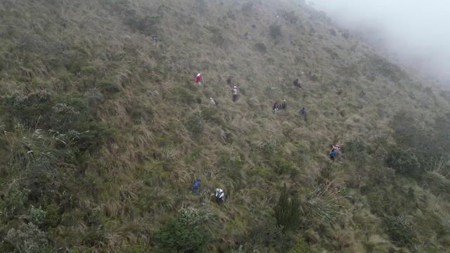
Drone footage from one of our projects in Ecuador, showing the scale, terrain and teamwork behind restoration.

Ecuador

Community-led restoration in Ecuador’s highlands

Local communities are involved in every stage, from growing seedlings in nurseries to planting and monitoring, creating income and learning opportunities. Native trees are restored on degraded highland slopes, supporting a newly protected water catchment that helps regulate water across the landscape.

Active since
2023
Planting season
Nov–Feb
Tree species planted
11
Wildlife supported
150

Our UK & European planting methodology

A closer look at how we plan woodland creation across the UK and Europe.

01 – MAP THE SITE

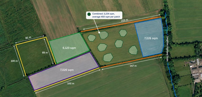
Map every metre of the site

Before any planting design begins, we georeference the site, pinning it to precise map coordinates, and map it down to the metre. This shows exactly how much land is available for planting.

Aerial mapping identifies existing woodland, surrounding vegetation, watercourses and access routes, and shows how the site connects to the wider landscape. We also use the Köppen climate classification, a global system for grouping climates, to understand conditions that influence species selection and planting season.

This mapping also creates the baseline against which the site is assessed and monitored over time.

Aerial map of a planting site with labelled areas, boundaries and distances

What we map:

  • Planting areaThe land available for woodland creation.
  • WatercoursesInfluencing site design and species placement.
  • Access routesPractical requirements for planting and management.
  • Surrounding vegetationUnderstanding the existing ecological context.
  • Climate zoneIdentifying the site’s Köppen climate classification helps inform species mix and planting season.

02 – SCREEN CONSTRAINTS

Finding the right places to plant

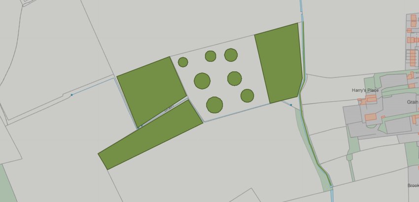
Before developing the planting plan, we screen each site for statutory, ecological and physical constraints, so new woodland is created only where it benefits the landscape.

In the UK and across Europe, we use national and regional mapping datasets to assess protected areas, priority habitats, flood risk, wildlife pressures and historic land use. Examples include DEFRA and Environment Agency data in the UK, IGN’s National Forest Inventory in France and Germany’s Federal Forest Inventory.

Our aim is woodland that complements the existing landscape and protects valuable habitats.

Map of the same site showing the planting areas and the watercourse running through it

What we screen for:

  • Protected areasSites of Special Scientific Interest (SSSIs), Natura 2000 and Ramsar wetland sites are legally protected, so we exclude them from planting.
  • Flood risk & groundwaterFlood and groundwater data help inform site suitability and species choice.
  • Priority habitatsValuable habitats, such as species-rich grassland and peatland, are identified so that planting supports rather than harms them.
  • Wildlife pressureDeer and wild boar pressure is assessed to decide whether young trees need extra protection, such as guards or fencing.
  • Historic land managementPrevious land use can reveal soil impacts, such as compaction or nutrient enrichment, and shape how the woodland is managed.

03 – ANALYSE THE SOIL

Matching trees to the ground beneath them

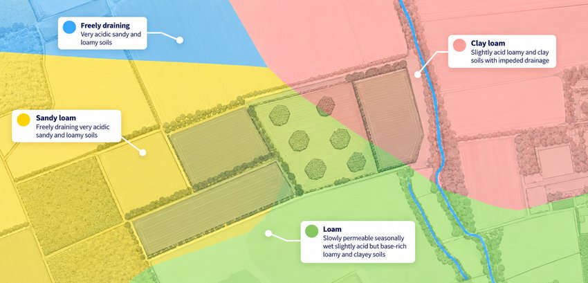
Tree species respond very differently to the conditions beneath the surface, so understanding the soil is a critical step in deciding which trees are most likely to establish and thrive in each part of a site.

We use national and regional soil datasets to understand the dominant soil characteristics across each planting area. Examples include LandIS and Soilscapes in the UK, GIS Sol and INRAE data in France, and state-level soil mapping in Germany, coordinated with the Federal Institute for Geosciences and Natural Resources (BGR).

We then combine this evidence with local observations and landowner knowledge to capture variations that national datasets may miss.

Aerial view of the site coloured by soil type: freely draining, sandy loam, clay loam and loam

Three key characteristics

  • Soil pHWhether soil is acidic, neutral or alkaline affects which nutrients trees can absorb, and helps determine which species suit the site.
  • Soil textureThe balance of sand, silt and clay affects how well soil drains, how much air and water it holds, and how easily roots can grow.
  • Soil moistureMoisture levels can vary across a single site. Some species tolerate waterlogged ground, while others need much drier conditions.

04 – DESIGN THE HABITAT

Designing natural, varied woodland

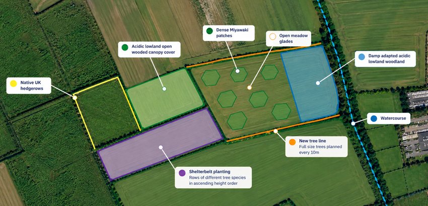
With the landscape, constraints and soil understood, we begin designing the woodland itself. The aim is a site that reflects the natural woodland composition appropriate to that location, rather than applying a uniform planting pattern.

Different areas within the same site can therefore have their own species mix and density. Water-tolerant species such as willow and alder go in wetter ground, while open clearings, native hedgerows and shrub zones add variety for wildlife.

In the UK and across Europe, trees are typically spaced 2–4 metres apart, depending on the species and restoration objective.

Planting plan of the site: hedgerows, open wooded canopy, Miyawaki patches, meadow glades, damp woodland, a shelterbelt and a new tree line

Key design principles

  • Natural woodland compositionReflecting the types of woodland that naturally grow in the region.
  • Diverse species mixCombining native species, which makes the woodland more resilient to pests, disease and a changing climate.
  • Structural diversityHaving a variety of vegetation heights creates more places for wildlife to nest, find food and shelter.
  • Natural successionPlanning for how the woodland will change as it matures, from young saplings to an established canopy.
  • Specialised structuresFeatures such as shelterbelts (lines of trees that shelter land from wind) where a site needs them.

05 – MODEL THE SPECIES MIX

Selecting species using independent datasets

We combine everything we’ve learned about the site with independent forestry datasets to determine which species are best suited to each planting area.

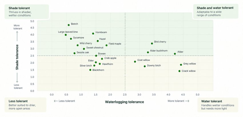
Treeapp has developed a species-selection model that assesses each species’ tolerance to soil pH, moisture, soil texture and shade. These characteristics are matched against the conditions identified during site assessment to narrow down the species most likely to thrive.

We then consider nearby woodland composition and local biodiversity, so the final species mix also complements the wider ecological context. Every final mix is reviewed by our forestry team and approved by Treeapp’s Head Forester, who holds a PhD in Forest Ecology.

Chart of about 25 UK tree species plotted by waterlogging tolerance and shade tolerance, in four groups

Evidence sources

  • UKForest Research – Right Trees for a Changing ClimateForest Research – Ecological Site ClassificationRoyal Horticultural Society – Climate Resilient Tree Planting Research
  • FranceCNPF – Centre National de la Propriété ForestièreONF – Office National des Forêts
  • GermanyFNR (Agency for Renewable Resources) – Wald portalBundeswaldinventur – Germany’s National Forest Inventory

We also draw on the IUCN Red List of Threatened Species and academic research.

06 – PREPARE THE PLANTING

Sourcing healthy trees and planting at the right time

With the design and species mix approved, the focus turns to the quality of the trees and when they are planted.

We source from trusted UK and European nurseries that pass our procurement and due-diligence checks, prioritising suppliers within around 100 miles of the site. All suppliers must hold Plant Healthy certification or an EU Plant Passport, reducing the risk of introducing pests and disease.

For each site, we choose the most suitable type of young tree. Bare-root trees are grown in nursery fields and lifted from the ground without soil, while cell-grown trees are raised in small pots that keep a plug of soil around their roots, helping them cope on more exposed sites.

In the UK and Europe, planting usually takes place between late October and early March, while trees are dormant.

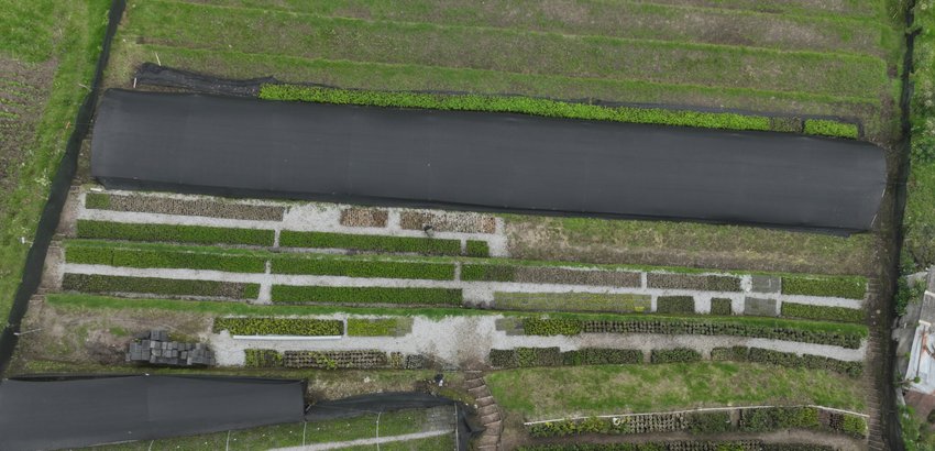
Aerial view of a UK tree nursery with rows of young trees and saplings, weed-control fabric and gravel paths, ready for winter planting.

Preparation checklist

  • Local sourcingNurseries within around 100 miles prioritised where possible.
  • Biosecure stockAll suppliers must hold Plant Healthy certification or an EU Plant Passport.
  • Site-appropriate stockBare-root and cell-grown trees are chosen according to site conditions.
  • Seasonal plantingTrees are typically planted between late October and early March.
  • Professional planting and inspectionCarried out with local foresters and arboriculturists, and inspected after completion.

How we monitor our planting sites

Planting is only the beginning. Ongoing maintenance and monitoring help each site grow into a healthy, resilient ecosystem.

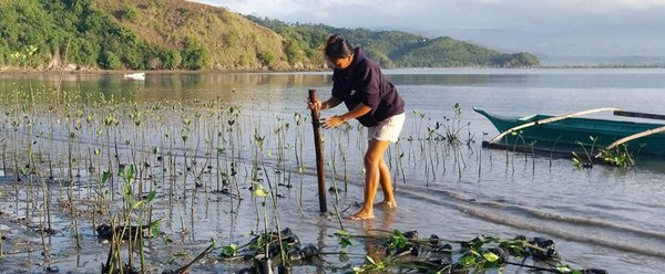
A team member pushing a stake into the water among young mangrove seedlings on a shore

On the ground

In-person monitoring and maintenance by local teams


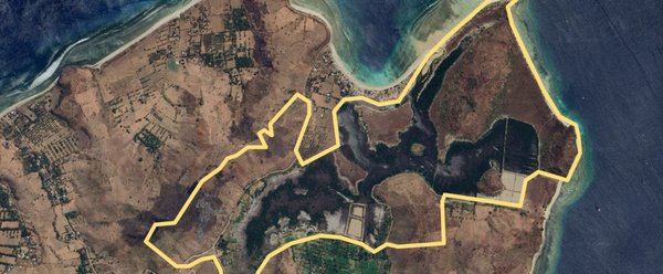
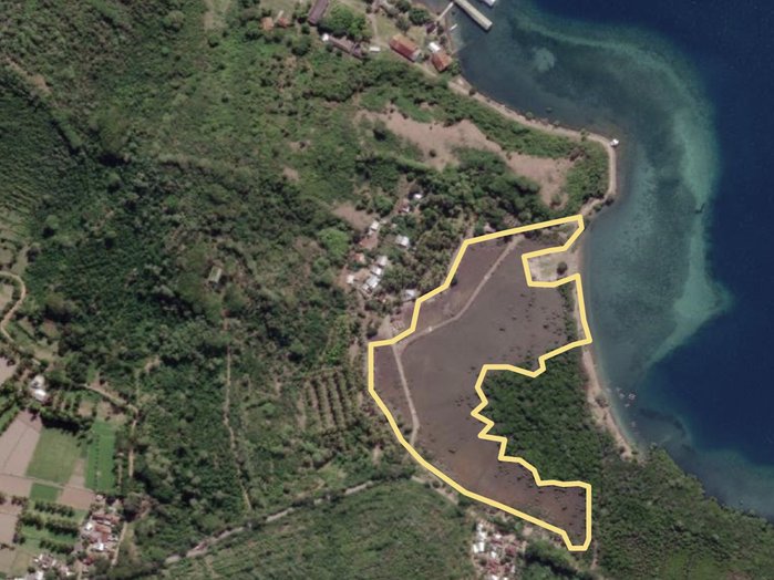
Satellite view of a coastal planting area outlined in yellow

From above

Remote monitoring of how entire sites change over time


How we measure planting success

The key indicators that show how trees are establishing and how each ecosystem is recovering over time.

Stocking density

The number of surviving trees within a defined area, helping us assess whether the site is developing towards its intended planting density.

Canopy cover

How tree cover develops across the site, helping us understand ecosystem recovery and identify competing growth that may affect young trees.

Diameter at breast height

Trunk diameter measured at around 1.3 metres high, a forestry standard used as trees mature to track growth and woodland development over time.

Leaf health indicators

Leaf colour and bud development, along with premature browning, help us assess whether trees are healthy and establishing successfully.

What makes our projects credible

Four commitments behind every Treeapp project, so restoration is protected, responsible and built to last.

Land rights & long term stewardship

We agree clear responsibilities with landowners and local teams. Where relevant, legally binding agreements protect trees for a defined period and set out maintenance obligations, backed by Treeapp monitoring.

Environmental due diligence

We assess each ecosystem before deciding whether planting is appropriate, checking land use and protected habitats. National datasets and site visits help ensure restoration strengthens the landscape.

Local expertise & community engagement

We combine our methodology with local forestry, ecological and community knowledge. Before planting begins, we consider how the land is used, who depends on it and how restoration can support local needs.

Treeapp oversight and standards

Treeapp sets the standards behind each project and reviews the methodology and evidence used to design it. We maintain oversight of planting quality, species selection and delivery alongside local experts and teams.

Our 2026 Impact Report

We’re very proud of the impact we are having year on year.

Check out our 2026 Impact Report to see how we have made our mark and what we are planning next!

Take a look(opens in a new tab)
Impact Report 2026 cover

Start your sustainable journey today!

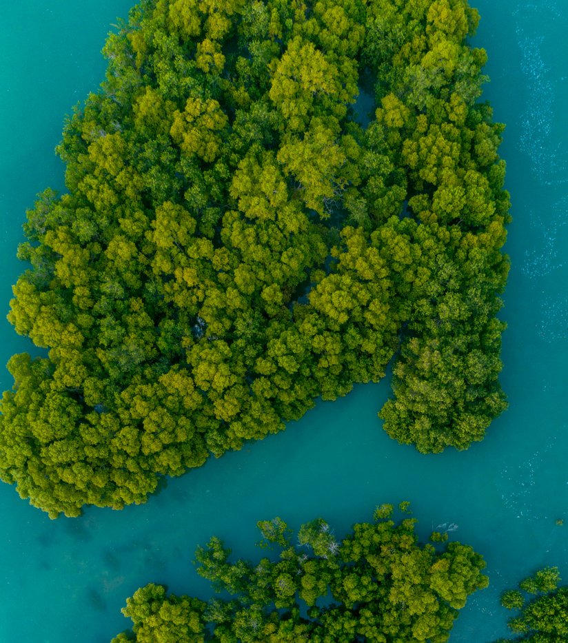
Aerial view of mangrove forest with dense coastal trees that help protect biodiversity and coastal ecosystems.

Trusted by:

Treeapp partners with Virgin Music Treeapp partners with L’Oreal Treeapp partners with the Ministry of Justice Treeapp partners with Sanofi Treeapp partners with Marriott Treeapp partners with DPD

Contact us

Fewer than 10 employees? Get started here(opens in a new tab)

Min 3 / Max 60 characters
Min 2 / Max 35 characters

Use your business domain, e.g. name@yourcompany.com

Please enter a valid email
Min 7 / Max 25 digits

e.g. we’d like to plant 1,000 trees for Earth Month

Get a response in under 24 working hours!

Want to get started even faster? Book a call with our experts at a time that works for you.